| Home | Travelogues | Pictures | Tibetan Language | Various |
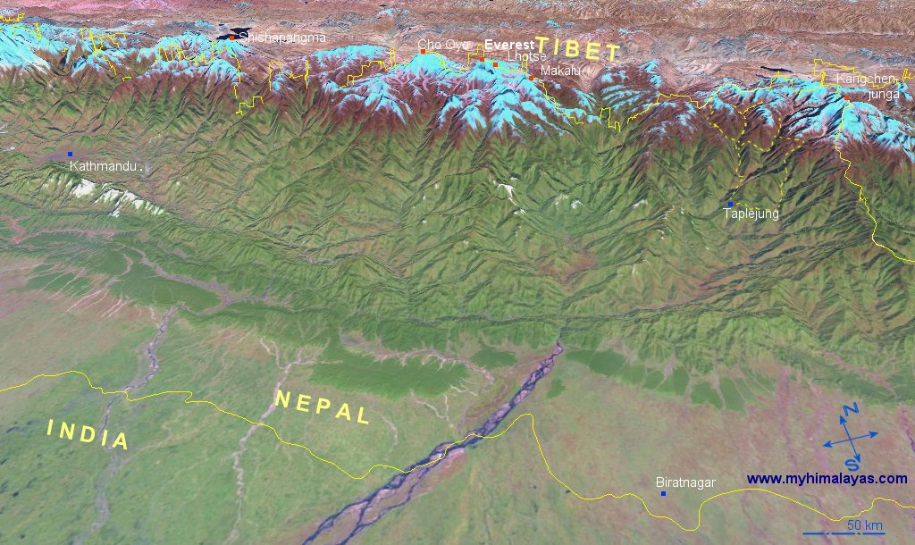
3D Map of Kangchenjunga and Eastern Nepal from NASA:

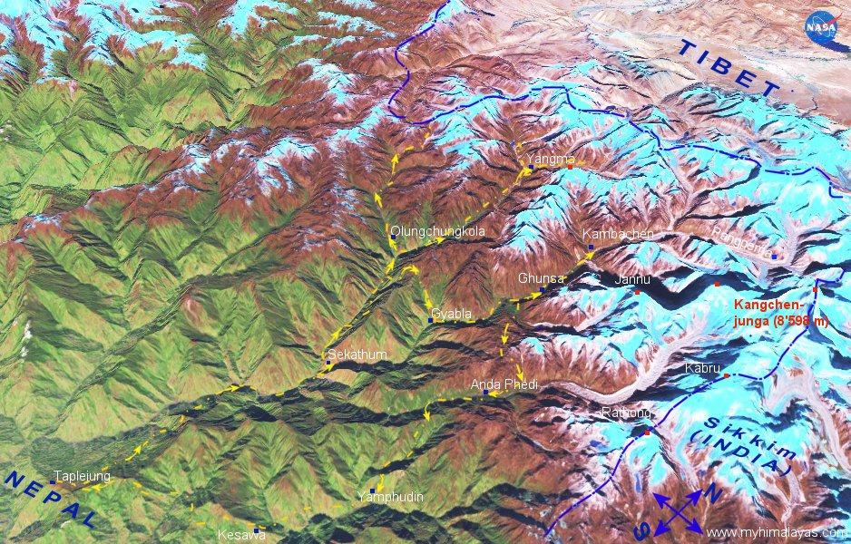
3D Map of Kangchenjunga, Ghunsa, Taplejung, Yangma and south side route back:


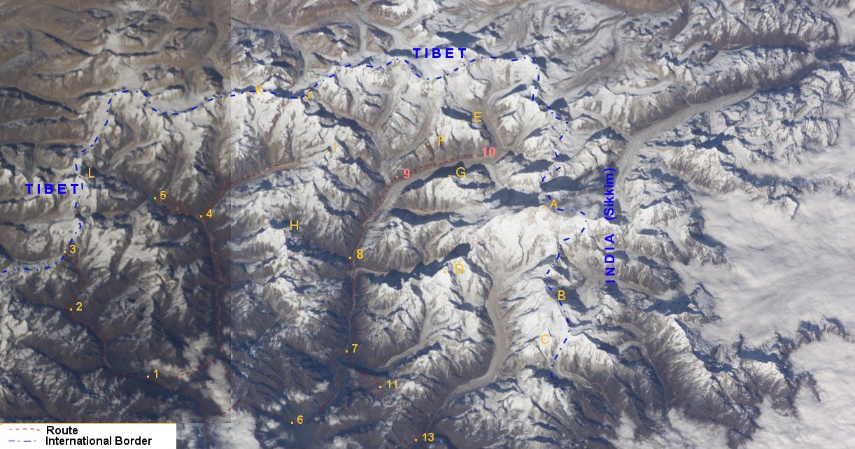
| Route | Mountains |
| not on map is Suketar in the south | A Kangchenjunga Main Summit (8'586 m) |
| 1 Olungchungkola | B Kabru (7'353 m) |
| 2 Mauma Kharka | C Rathong (6'679 m) |
| 3 Tiptala Bhanjyang (then back to Olungchungkola) | D Jannu, aka Khumbukarna (7'710 m) |
| 4 Yangma | E Drohma Peak (6'850 m) |
| 5 Cheche Pokhari Lake | F Tengkoma (6'215 m) |
| 6 Gyabla | G Wedge Peak (6'750 m) |
| 7 Ghunsa | H Sarphu aka Tangga (6'435 m) |
| 8 Kambachen | I Tinjung and Dango (6'097 m and 6'250 m) |
| 9 Lhonak (on different trip, see here) | J Omnikang Ri (6'839 m) |
| 10 Pangpema (on different trip, see 9) | K Syao Kang |
| 11 Selele La | L Nobuk (5'945 m) |
| 13 Anda Phedi | |
| not on map is return to Suketar in the south |