|
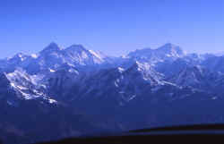
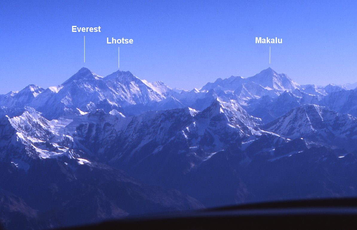
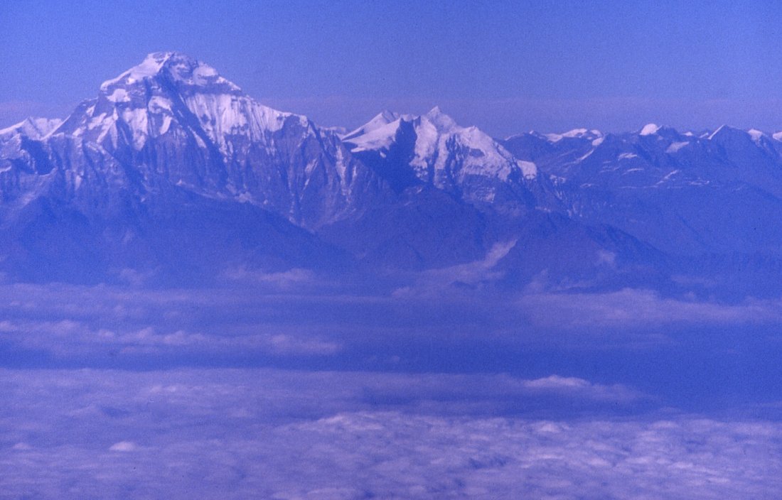
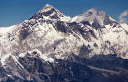
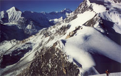
From south-west: Mountain flight to Everest - an easy way to see Nepal's 8 peaks over 8'000 meter.
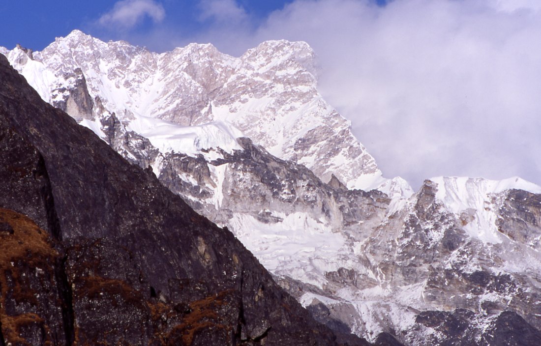
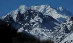
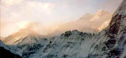
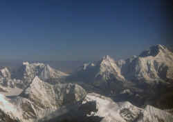
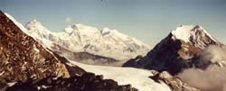
Here are three: Everest (8'848 m) is the black pyramid on the left, just
to the right is Lhotse (8'516m ), Makalu (8'485 m) is the high
peak on the horizon on the
right. Both peaks tower above countless smaller ones in the Khumbu region. Ama
Damblam for example is just below Makalu.
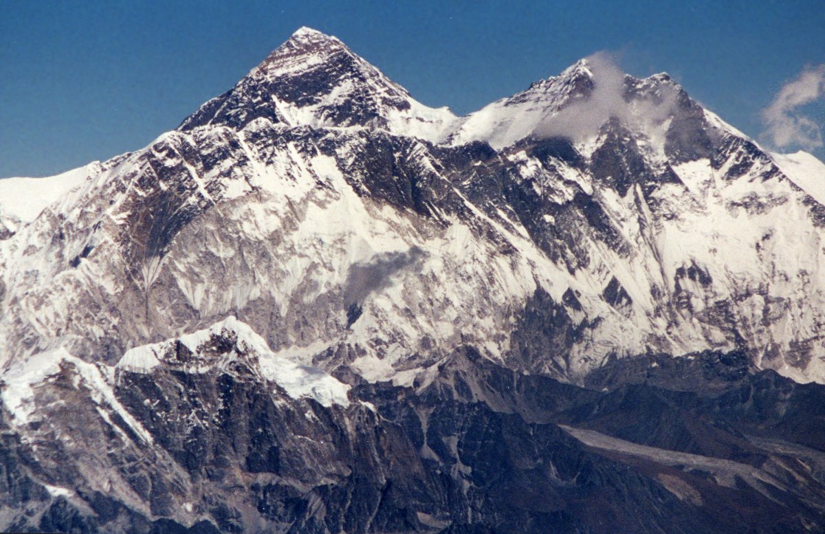
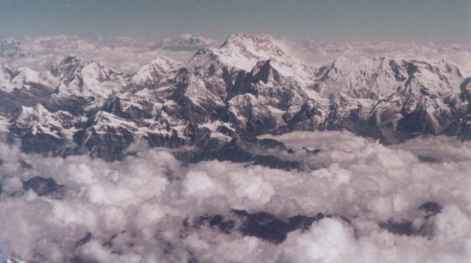
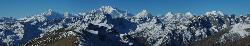
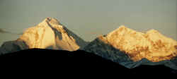
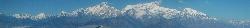
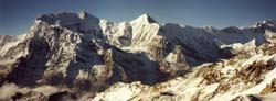
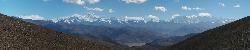 Panorama with 4 peaks over 8'000 meters - Makalu; Lhotse; Everest; Cho Oyo.
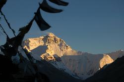
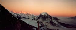
 Late afternoon in Ronguk reveals the north face of Everest; or Chomolungma how it is called by Tibetans.
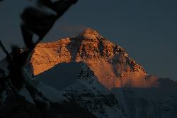
 Start of sunset.
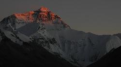
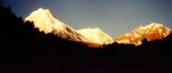
 Late sunset on north face.
 Sun setting even further.
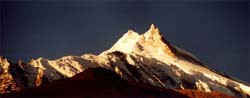
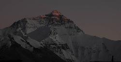 Sun on the summit; dusk has already set in.
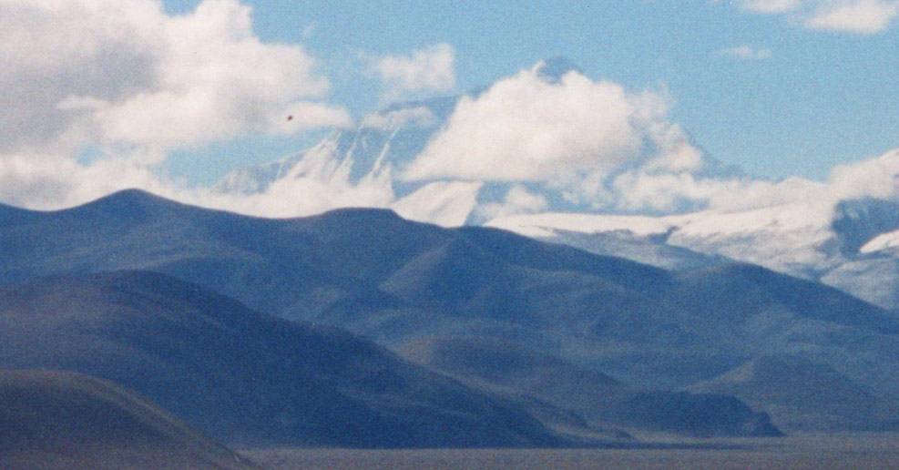
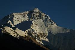
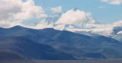
From Tingri.
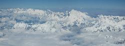
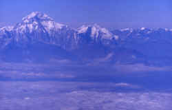
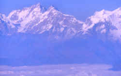
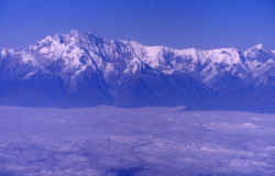
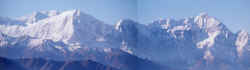
During flight to Tibet, 4 of the highest peaks on earth.
From
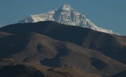
north-west: Everest rises above the flat Tibetan plateau which is itself is already 4'000 meters high.
Everest Kangchung east face on the way to Lhasa.
|
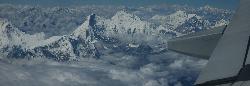
I've never
been to the Karakorums, the closest I got was seeing some huge peaks on
the flight to Ladakh. I thought I would go there soon, but the timing
never worked out. |
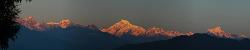
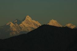
Kangchenjunga sunrise from Gangtok in Sikkim. 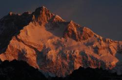
Sunrise from Dzongri in Sikkim.
From Emchi gompa in Sikkim.
From Goecha La, a 5'000 m in Western Sikkim.
East face from North Sikkim
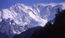
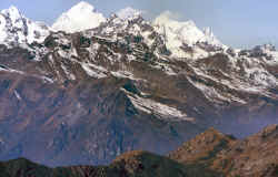
Panorama of the range between Nepal and Sikkim, with Kangchenjunga as the
highest summit in the long chain.
South face from Lhasiya Bhanjyang, a
low pass in he middle hills in Nepal. The triangular peak in the middle is the true summit.
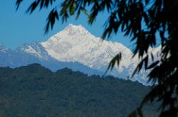
South face, the main summit is the pyramid on the left.
The north face is as impressive as the south side, here the morning
sun hits the main peak in the background. Taken in the early morning while
climbing, or rather attempting, Tengkoma peak.

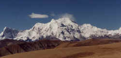
Kangchenjunga from west during the flight from Kathmandu (Nepal) to
Lhasa (Tibet)
|
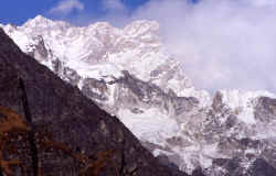
The long ridge in the middle belongs to Lhotse.
|
South face of Makalu, fifth-highest peak on
earth.
From a pass near Kangchenjunga it's possible to see the east face of Makalu and
Everest, both are 50 miles away.
Makalu during flight to eastern Nepal.
During flight to Tibet.
|
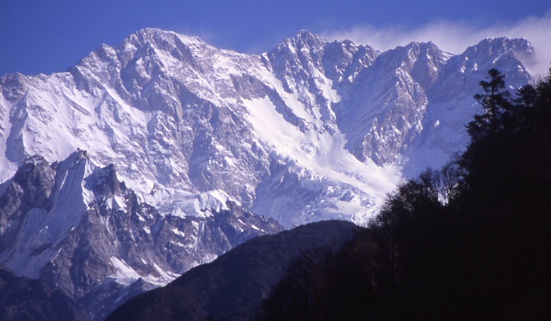
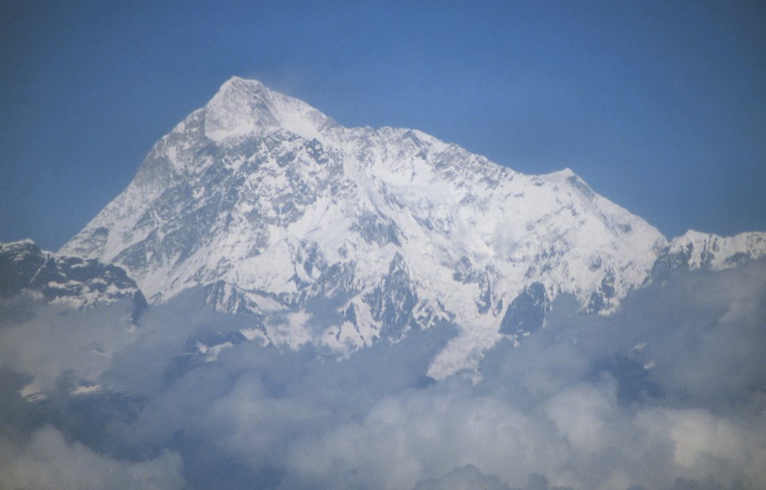
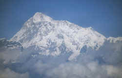
Cho Oyo (8'201), one of the technically easier summits on the border between
Nepal and Tibet.

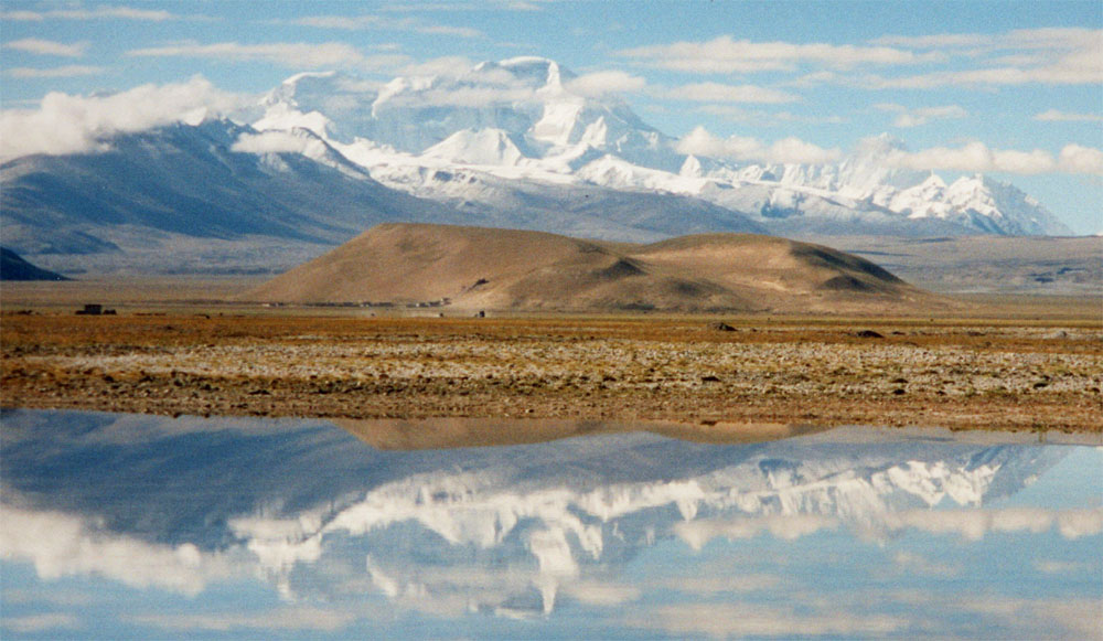
The 6th highest peak
reflects in a pond between Lhasa and Kathmandu. Usually expeditions climb
this northern face. 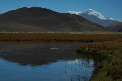
From Tingri plain.
Afternoon sun from Tingri village.
|
The early catches the worm, getting up early is often rewarded in the
Himalayas. From the holy site of Muktinath the views of the north-east
face is stunning.

Sunset on the "White Mountain", view from south.
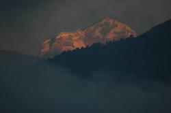
Sunrise from Pokhara.
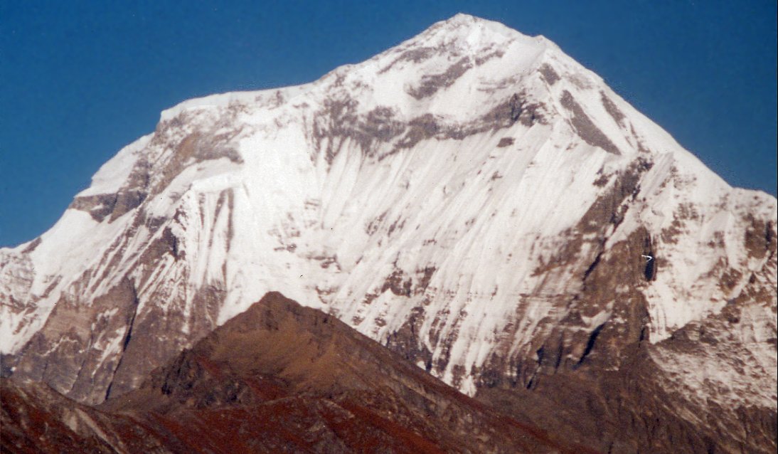
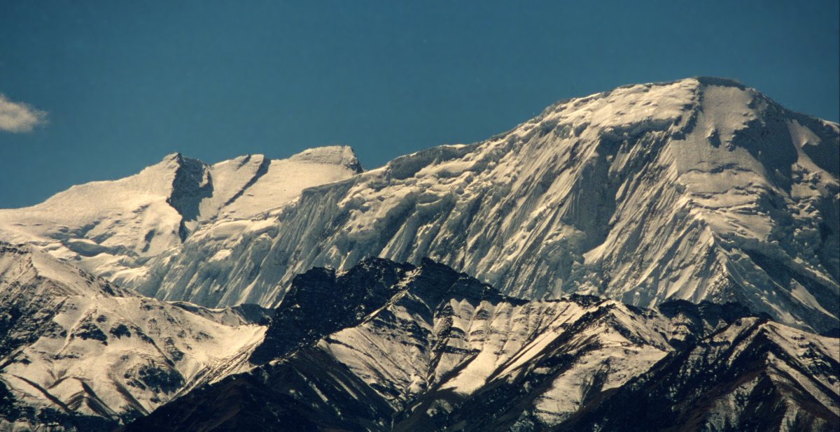
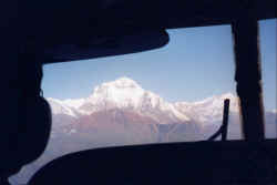
Dhaulagiri (8'167 m) is the westernmost high peak of Nepal, this picture was
token during the regular flight from Kathmandu to Delhi.
Flying from Pokhara to Jomsom (for Mustang trek) reveals the stunning peaks
of the Dhalagiri and Annapurna massiv.
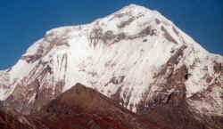
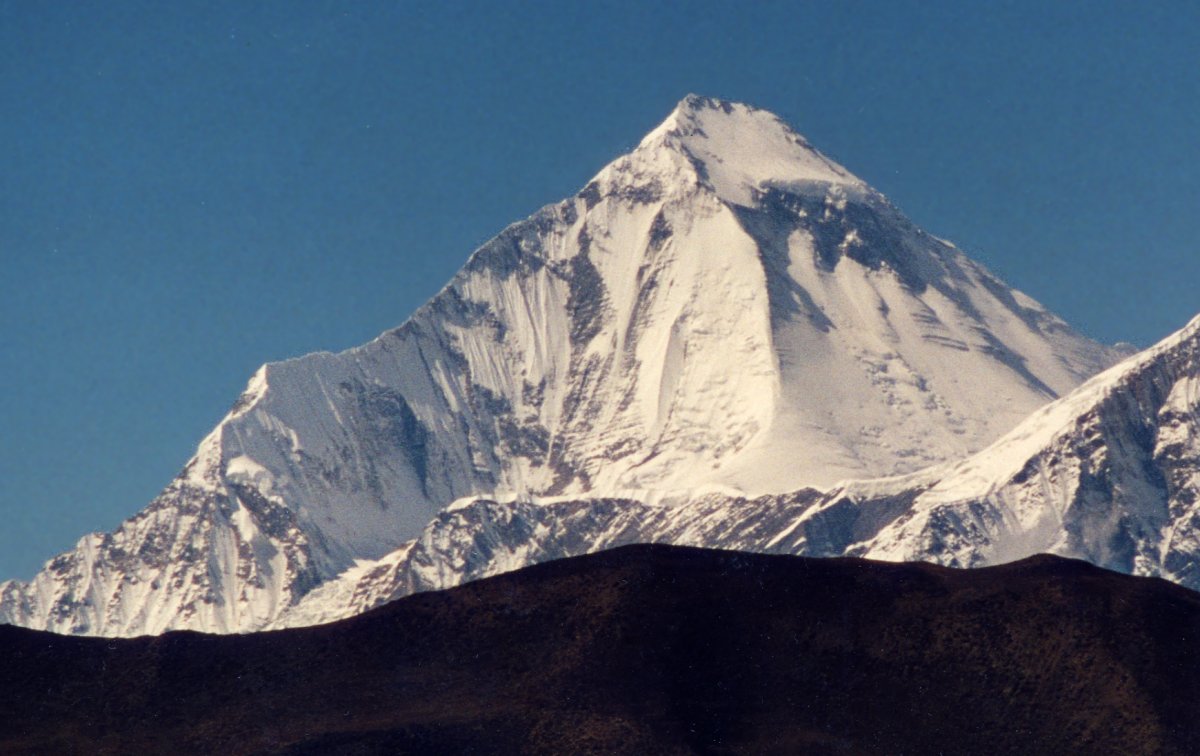
The 8'000 meter peak dominates the range to the west, several routes lead up
on the steep south face to the summit 8'167 meter.

Dhaulagiri's north-east face from the pass between Tetang and Muktinath

View of south-face during Annapurna Circuit trek.
|

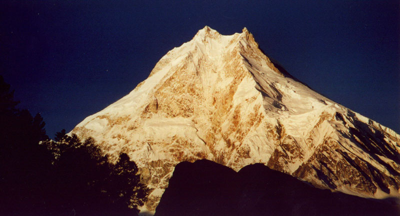
The subtle changes of the light on the ice of Manaslu are terrific, turning from grey to
pink to orange to yellow and then the 'regular' white.
The valley is already in the shade, but the sun is still setting on the
Manaslu massiv. This picture was taken from the north-west at the high
camp for Chulu Far East.
The valley still lies in darkness when the sun hits the top of Manaslu and its
satellites.
Once again the sunrise is beautiful, Manaslu does not appear to be 8'000 meters
high from Sama.
On the way home from Kathmandu to Delhi: Manaslu
After climbing a nasty scree slope we break camp on the saddle between the
ridges of Chulu East and Chulu Far East. Manaslu (left) rises high above all the
other mountains.
Panorama during flight to Pokhara.
From Nagarkot, Manslu is the pyramid on the right side.
|
I hope someday I'll visit the Karakorum |
From south: Annapurna south face from the airplane on the way to Delhi. The
main peak is covered by mist.
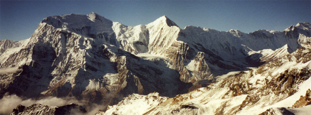
From East: Why do people climb mountains? This picture should answer all
questions. View on the Annapurna range while climbing Chulu Far
East.
Gangapurna is on the left, the very right is Annapurna I (8'091 m)
From East: View from the high camp during the Chulu
East climb.
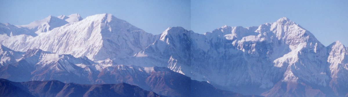
Stunning Annapurna range, a view that opened up unexpectedly while
walking to Upper Mustang.

From north: The summit of Annapurna I in the left is the highest point of
the Annapurna range, but the steep ice flanks of Tilicho that stands in
front of it are not any less impressive.

Sunset from west during a trek down the Kali Gandaki valley two days
after Jomosom.
|
I hope someday I'll visit the Karakorum
|
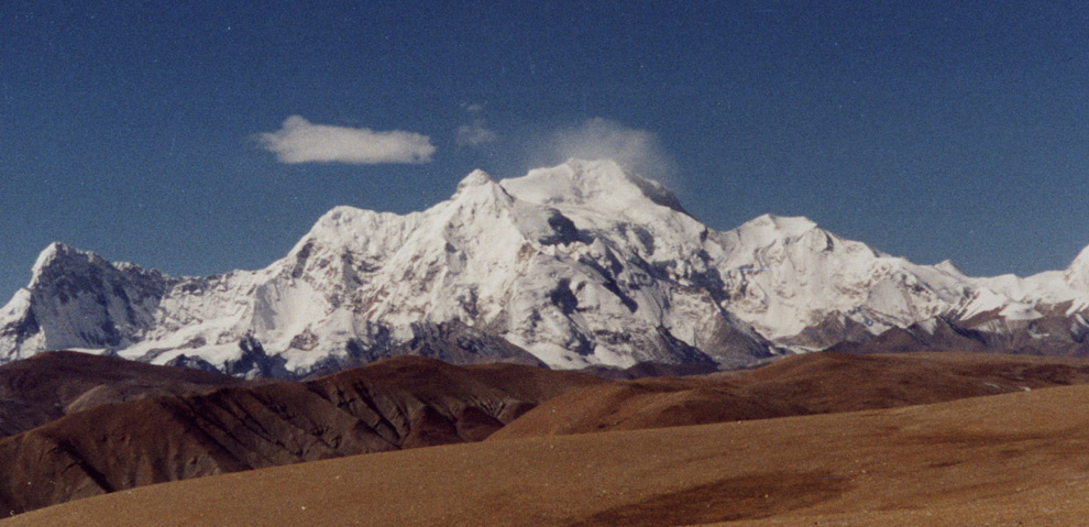
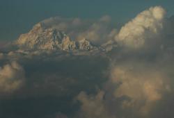
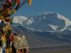
From the pass in the north-east the ice-clad faces of Shishapangma contrast sharply against the barren hills of the Tibetan scenery.
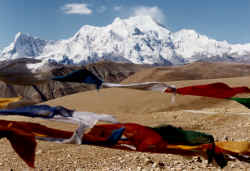
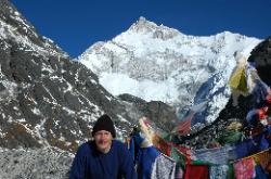
Prayerflags flatter in the strong on top of the pass.
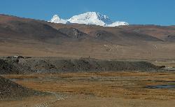
Approaching the pass with Shishapangma rising above the barren hills of
the Tibetan plateau.
|