MyHimalayasimpressions from |
|
|||||||
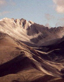
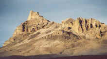
The isolated mountain shortly before reaching the Charkha valley does not seem
to be in the landscape.
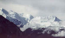
The Dhaulagiri massif, seen from the northwest. Dhaulagiri I is hidden behind
the black mountain.
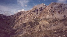
We follow the blue Barbung Khola upstream to Charkha.
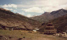
All of a sudden we reach Charkha, an isolated village which looks like a
fortress.
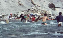
We are definitely off the beaten track - bridges have been washed away and are
not replaced yet - but luckily we do not have to cross rivers very often.
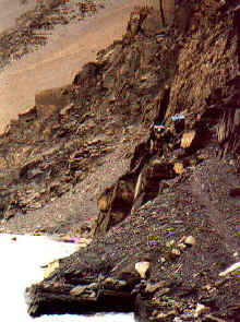
Trails are also getting more difficult, we choose the winter trails near the
river but sometimes the water level is still too high and we have to climb a
little.

On the way to our last pass, Sangda La. It has snowed during the night which
makes the scenery even more impressive, but also makes walking more difficult.
Dolpo to Mustang: Charkha - Sangda
Charkha to Sangda
Keheng Khola – after Charka (Day 14)
I hear footsteps in the night, they sound like someone walking around on snow with plastic bags over their shoes. It is one the sounds I have coem to dread, that’s why I remember it so well. I get up. But nobody is there, it was probably just a grazing animal. The sky is absolutely clear again at night, in addition to the countless bright dots on the firmament I spot two shooting stars.
Thick fog in the morning creates an uncomfortable cold that is increased by the shade. If I had known that the sun will reach the camp half an hour later I would have suggested to start later than usual: taking down the tent, packing, serving food must be miserable for the helpers. Once we start walking the cold is gone.
A large male yak runs down from the pass and I am not the only one looking for escape routes in case the animal comes too close. Luckily it passes us in some distance. We camped at the source of Keheng Khola, now we cross the watershed on whose other side springs a creek that flows into Barbung Khola soon afterwards. The mist comes from all sides, when it descends over the ridge and slowly hides the valley it gives it a fairytale touch which impossible to capture on film.
The view south into the Barbung Khola valley is totally different. Although the sun has not yet dissolved the fog completely, the lower part of the broad valley is clear. It is bound by steep dark mountains, the river which runs in it makes a 90° turn near the pass. Far ahead are snow peaks, to our right is the Dhaulagiri range but it is too cloudy to see the summits. I vainly wait for it to clear up, and after a few minutes on the cold pass I follow the others who went ahead. The sun’s warmth has burnt off the clouds by the time I catch up with them. Huge white mountains become visible to our right, after fifteen minutes of waiting we see Dhaulagiri II to V with their enormous icefalls and glaciers. A large black mountain hides the summit of Dhaulagiri I, hopefully we will have nice weather and see it the massif’s highest peak from Sangda La.
The blue river turns away from us and disappears in a narrow valley. When it meets with the Tarap river three days downstream it changes its colour and name into Bheri. At Dunai the Bheri is a broad black-coloured stream, the same river before Charka is a much “small” glacier-creek. When people back home ask me how many miles we walked I am bewildered at first because I have never thought about the distance in kilometres. After four days of walking you start measuring distances in terms of peaks, passes, rivers or changing landscape.
For the entire morning the scenery is desert-like and offers little variety. The low bushes on the yellow mud are not captivating, but the blue river and steep mountains are spectacular. The chorten far ahead is a relief, it is probably the first announcement of Charkha, we reach a second more elaborate chorten a few minutes later and overlook a small plain of barley fields and a village. Many chortens are built on the surrounding hills, looking like turrets defending the two dozen houses of Charkha. I imagine that they do offer a feeling of safety and protection from bad luck. The village looks like a fort, tall houses are built close to each other, its outer walls connected. A few buildings are scattered around it, a landslide destroyed the monastery across the river, it has been replaced by a new one below the entrance chorten.
A number of maniwalls and chortens have to be passed before reaching the village. It is almost impossible to pass them correctly, the first two are Bon, and the third one is Nyingmapa. Or maybe it is the other way round. Closeby is a Bon monastery and the monk has time to show us the two main halls. The more important looking one has not been finished, the walls are not painted yet, but it already contains some statues and racks of books. The masks worn at festivals are kept in the larger adjacent room, which is empty otherwise except for a large statue of a lama.
A villager who died some weeks ago will be buried this afternoon. The monk asks me if I want to see the sky-burial. The body is carried to a special place on top of a mountain where it is hacked to pieces and left there for the vultures. Although it is very tempting, I decline - not because I am disgusted by it or because of the 3-hour climb to the site. But after all it is a burial and I have absolutely no right to disturb it.
The village is impressive, most buildings have high outer walls that are 4 metres high and appear like fortresses. The houses we have seen in Dolpo were all unpainted, but here some houses have been whitewashed, making the scene even more reminiscent of Mustang. Although politically still part of Dolpo, the culture and architecture seem to be influenced by Lo Manthang. I wonder if that similarity can be explained by a similar climate and the same building materials or if it is intended.
From our lunch spot at the river we enjoy nice views over village to the rugged mountains which we have crossed this morning. Groups of loaded yaks suddenly are coming from the east, accompanied by yak-herdsmen. Each group consists of about a dozen animals, and an elder man on a horse leads each caravan of four groups. They bring wheat and rice from Tibet where it is cheaper than in Jomosom. Because of the large numbers I first think that the caravans are from all Upper Dolpo, but they are all from Charkha. No wonder did it take us so little time to explore the town, the inhabitants are either on the pastures or away on trading. If the number of yaks and sheep are an indication of a village’s wealth, then Charkha is far more prosperous than it appears.
The amount of wood on the roofs could be a sign that like in Mustang the village is not completely abandoned in winter. The last winter was very mild, even the high passes remained free of snow. This reduced the amount of melted snow which is needed for irrigating the fields. On the other hand, winters can be too harsh: three years ago a vast number of livestock died in the Charkha valley and people had so much meat to sell that a leg of mutton was traded for a piece of soap (which costs about 20 cents in Kathmandu).
Usually the snow retreats in May, soon afterwards flowers and grass cover the ground. I imagine this to be the best season for trekking: snow covered mountains with blooming valleys. At that time of the year the agricultural season begins, irrigation channels are full of water and have to be cleaned to prevent them from overflowing. Two months later monsoon clouds cover the sky, heavy rain and storms are nothing unusual. In September it becomes very dry, harvesting begins and last until the end of October. Snowfall marks the beginning of the long winter, decades ago the villagers brought their cattle to nomads on the Tibetan plateau, but I don’t know if this can still practised. The Chinese occupation of Tibet has destroyed century-old business practices, and the influx of Tibetan resistance fighters was a burden to the local economy in the late 1960s.
A small procession of monks and two villagers walk upstream, one of them carries a bundle wrapped up in red cloth. The monks hold a long white cloth, recite texts and play the drums. At the village premises a monk starts carrying the body to a boulder near the river where two women stacked firewood. I am surprised because - unlike in Hindu culture where cremations are common and carried out near rivers- they are rare and happen on hills. It is also strange to see only two villagers – probably relatives – take part in the ceremony. I heard a few women crying when walking through Charkha, but traditionally they do not take part in the final ceremony that happens outside the village. The monks continue with their recital while the body is put on the pile of wood. This is the last thing we see before entering the sidevalley upstream.
After walking upstream five minutes we realize that the small river is too broad to jump across. Dawa tries it nevertheless and falls in – which provokes much laughter from everybody. Eventually I take off my shoes and wade through which is easy, the water is only knee deep and a few steps later I am already at the other side, but I feel little humiliated because I couldn’t jump across. When we pass a huge chorten with a 10 metre long prayerflag on a large chorten I wish the Charka people would at least use some of their architectural skills and wood for the maintenance of bridges.
Huge washed-out mountains form the other bank of the Barbung Khola, we follow the river on the easier side on gentle hills, but eventually take the path down at the water. It is shorter than the summer trail over the hills, but requires more climbing and balancing. Tomorrow we should follow the Thajang Khola which flows into the Barbung Khola on the other side. This means we have to cross the river. The washed away piles of stones on the shore means that the only thing left of the bridge is its foundation. Which means that we have to walk through 10 metres of waist-deep water.
The current is strong, the stones slippery and the water incredibly cold. This will be adventurous. Dawa crosses first, then the kitchen boys with their baskets. They all make it, but it takes them some time and more than once does it look as if they lose the balance and plunge into the icy water. It is our turn now, we start a few metres further upstream which allows us to be dragged by the current without having to worry about it. Camera, film, Walkman, tickets - everything could be destroyed by taking a single wrong step. We start very slowly and carefully. It becomes critical in the middle of the river because of a large boulder which is difficult to walk around when you hold hands with two other people who just walk on as if there was no obstacle. Somehow I get across the large rock. At least all the excitement lets me forget how freezing cold the water is. I hit my foot on some rocks but apart from a few scratches we arrive safely, dry, relieved and happy.
The second kitchen boy arrives and is definitely not happy about the missing bridge. He sets down his basket and stares at the river for two minutes, Padam’s laughing and yelling definitely do not help to cheer him up. Finally he takes off his shoes and throws them over. Then he crosses without too many problems. When the porters arrive a few minutes later the smallest one goes ahead, but when the water reaches his belly button he is afraid of taking a single step in any direction and stands helplessly in the river. Padam totally enjoys this and yells, laughs and screams the whole time, actually everybody does. Finally three other ports start wading through and with their and Dawa’s help the small porter also makes it. The remaining three porters (and my bag) get over quickly, despite the handicap of having to take care of the officer who crosses with them.
We set up camp right here which gives enough time to dry the things that became wet. I get the feeling that our crew enjoyed this little adventure as much as we did. As usually time in the afternoon passes slowly, and the closer it gets to dinner time the more it slows down, but finally the call ‘soup ready‘ signals another great dinner.
After Charka – before Sangda La (Day 15)
We start a little later than usual in the hope of getting nice views, but it is too cloudy. Nevertheless, we see all the way to the end of the Barbung Khola valley and the watershed which we crossed last morning. The mountain on Thagung Khola’s other side are a nice example of the powers that have created the Himalayas: layers of stone are mangled in a bizarre way, small springs come right out of the vertical rock and drop as waterfalls into the river.
After two hours in the valley it suddenly turns into very broad plain where three rivers meet. It is an idyllic place, looking like the stage of an amphitheatre surrounded by a black mountain on the one side and red washed out cliffs on the other. We continue to follow the biggest tributary upstream on the winter trail down at the water. During cold winters the rivers freeze and make walking easy - as long as you can follow the river, crossing passes is almost impossible. If the water level were just one foot higher we would have to take the upper and much longer summer trail. Half a dozen times the water is still too high and we have to climb steeply on slippery slate. The kitchen crew with their bulky baskets and slippers are unimpressed. The even parts are not much more pleasant to walk, boulders and pebbles require attention and rockslides slow us down. After three long hours the valley broadens and we stop for lunch.
We progress quickly towards what looks like the end of the valley ahead of us. Huge glaciers must have formed this landscape, for the first time on the trek I notice the sedimentation in the form of gentle hills and dunes. Otherwise it is dullest day of walking, the broad riverbed is not interesting and the grey clouds promise rain.
In the middle of the afternoon we reach a point where the valley splits into two smaller ones. They are separated by a big mountain, somewhere up there is the last high pass, Sangda La. A large herd of yaks is grazing on the meadows below the snow-covered summit, another herd is barely visible on a hill far down the valley. The sun strangely illuminates the dunes, increasing the subtle play of colours. The men watching the cattle live in a small stone hut across the river.
Dawa wants to see if somebody is there who can explain the best way over the pass. The herdsman we meet tries to explain the way, but it sounds very confusing and eventually he agrees (or offers?) to lead us tomorrow. I am not sure if he makes the explanation sound more complicated than it really is in order to earn a few extra rupees. Now I am pretty sure that this was his intention, people’s unharmful cleverness and sense for business always amuses me. Since we are short of kerosene and rice he sells tsampa and lets the porters cook in his dwelling.
The weather changes very quickly, the sky is clear one moment and five minutes later the blue is replaced by dark clouds. I hope it will rain cats and dogs tonight so we will have perfect weather in the morning to see Dhaulagiri and Mukut Himal.
Sangda La – before Sangda (Day 16)
During the night it started to rain heavily, and since we have put up our tent a the foot of a steep slope I wake up more than once hoping that the boulders are stable up there. All the rockslides we saw must have come down at one point, most likely after heavy rain... A very soft sound on the tent makes me curious and I get up early. The barren rocks of yesterday turned white, the sun is dimly shining through the mist. It has snowed considerably during the night, but it seems not very cold when we finally get up and pack our things.
Our ‘new guide’ is already here and eager to leave. Because finding the trail is soo terribly difficult he had to bring his friend as an assistant. Dawa is not too excited about having to pay two people, and after some negotiation only one of them takes us up the valley. And even this one guide would not have been necessary. But having a guide is always good, being lost is no fun, especially when there is snow it can become dangerous quickly. I got lost in a snowstorm in Zanskar once, and even though it makes for good stories afterwards it is not worth risking your life.
We climb for a few minutes to get to the spot to see Dhaulagiri I, a pyramid of ice and snow whose summit is 8’000 m high. Clouds in the valley make the massif barely visible. But some nearby peaks against the blue sky, albeit less high, are far more impressive anyway. Finally the snow gives the mountains the majesty they deserve; white 6’500 m peaks simply look more impressive than ochre ones, especially if you are standing at 5’000m yourself. The sun has melted most of the snow near the river, but it becomes ankle-deep by the time we reach the first chorten. It does not mark the pass but is simply a landmark. We have climbed quite a bit already, it comes as a big surprise to see the pass so high above us.
The sun shines brightly: perfect conditions to become snow-blind. Of course most porters do not have sunglasses – the snow is quite unusual for this time of the year. Some go on completely ignoring the sun, others try constructing sunglasses out of brown plastic bags. It is hilarious to see Padam trying to put a much too small bag over his head. He succeeds and makes to small holes in it to look through. Seeing him like this is probably the most comical situation on the whole trek and everybody laughs like crazy. He has the talent to make amusing situations even more funny and I think I will never forget two scenes: Him standing in the river after Charkha and with the plastic bag just before Sangda La. When we set off I hope that nobody suffers from too much sun.
Our local guide turned back at the chorten after pointing to the trail which can be made out despite the snow. It leads up to the ridge on the left, at first we walk across a flat plain, then a strenuous climb begins. Dawa is literally running ahead, despite the fact that he has to make the trail I have no chance of keeping up. I try not to guess how it will take to the top and simply follow in his footsteps. But resisting is impossible and more than once do I look up, only to see him far ahead and the pass further away than before. I do stop occasionally for some rest and to enjoy the fine views of a massive mountain to the right of the pass, clouds move in and out of the flanks of Malung Kang (6'120 m). The views back to the broad valley are less dramatic but also worthwhile, subtle changes from brown hills to the white snow under the dark blue sky are pleasing for the eyes.
Behind me is a young porter, followed by Khami and Thomas. I do not realise that the porter is walking barefoot in his slippers, he has to stop more and more often to sit down in the snow and warm his frozen feet with his hands. When Khami passes he gives him a pair of extra socks which offer at least a little bit of protection against the cold. Dawa assured me that all porters were given adequate equipment, shoes and jackets before the trekking. But for some reason two of them sold or traded their shoes with the two porters who left us in Do. Dawa feels a bit uncomfortable because it takes some time until the first porters show up, but eventually everybody has made it.
I can marvel at the fantastic mountains for a few minutes before the fog on pass gets too dense. The climb has been long and exhausting, nobody is eager to stay and we descend quickly on a steep snow-free gravel flank. Fog and mist are constantly coming from the valley, but we can enjoy lunch without being drowned. A herd of goats is coming from the pass shortly after us. They are not eager to cross the river and it takes the shepherd some time to convince them. Throwing stones proves useless, so he grabs the bell-weather and throws it in the river. Of course the poor animal is running straight to the closer bank and the other animals follow.
Just after lunch we get into a heavy and constant rain which will last for most of the afternoon. A small white stream winds itself down a narrow black gorge, this part of the path is slippery but otherwise fine. But as soon as we leave this ridge and turn left at a prayerflag, the path simply disappears. From a little plateau we look down a steep, steep slope which is filled with small pieces of broken slate. I feel like standing on the rim of a funnel I am about to ‘walk’ down. We do not even attempt to follow the path anymore, instead we just slide down, trying to remain in control of speed and direction. It is difficult and I almost fall more than once. After 20 minutes of such ‘walking’ it becomes more flat and the most difficult part of the trail is over. Crossing from the other way must take at least a day, if it is possible at all. And because there are no places to put up a camp you have to walk to a high altitude without having time for proper acclimatisation. I am glad that Pasang and Jamie were so adament in suggesting to walk from west to east. Visibility is reduced to 50 metres, but since all the different trails run close to each other there is no risk of getting lost - or more exactly - no risk of losing the officer who is far, far behind.
Man-sized boulders on the black ground give a morbid impression when they slowly appear out of the fog as we approach them. My mood has suffered quite a bit since this morning: it started as a perfect day but now we are descending in mist and rain on a muddy, slippery path and cannot see anything but mist, rain, and a muddy, slippery path. At least my gear keeps me warm and dry, and the umbrella and the Walkman make the rain barely noticeable.
The gravel disappears the further we get down, as we reach a forest of gnarly conifers the trail is getting better and walking is more enjoyable. It is a completely different landscape than the last few days, smelling the resinous scent of trees feels like a luxury. Eventually we reach a plateau with barely enough space for our tents, but Dawa suggests continuing to the next site fifteen minutes further down. It is a little bigger and has enough terraces to set up the tents. It is still very steep, the river to our left is a constant waterfall. When I see the dark brown water in the creek I am not very convinced that this is a suitable place to stay. Luckily there is a tiny spring just next to the river. We put up the tents, happy to have ended this miserable day earlier than usual.
I could not find a single picture or any information about Sangda when I prepared this trek. Now I know why: snow makes the passes uncrossable as early as October and in summer the valley is too foggy to take pictures. Once again I am too pessimistic, two hours later the fog is dispersing, slowly giving way to nice views of the peaks on our right (Mukut Himal and Tashi Kang I assume) and the precipitous path in the canyon wall which leads to the terraced fields of Sangda.
The view from further up must be fantastic: huge mountains to the right and a deep canyon below it. But I am grateful to have seen just a little before dusk; the impressive valley with the junipers, the glaciers and the village far down. I can imagine what it looks like on clear days, and this is enough for compensation for the hardships and disappointments of a rainy day. Days like this make you appreciate fine weather and views, it is an essential part of a successful trek - as long as comes in well tolerated doses.
|
Summary Part 5:
After crossing a low pass we enter the Charkha valley. The dark blue Barbung Khola makes a sharp turn in front of a black mountain which stands in front of the Dhaulagiri massif. The Charkha village is built in a river bend, surrounded by yellow fields. The tall buildings are connected and appears like a deserted fortress, since most people are away in the summer. After wading through the waist-high river we are on our way to the last pass, Sangda La. Snow the next morning makes clear why this route cannot be taken in autumn. It makes the crossing not easier, but everybody arrives safely at the top. The way down towards Sangda is much more difficult. The loose gravel slopes are even less stable because of the rain, and the trail simply disappears. Eventually we arrive at a small plateau where we can set up the tents. In the afternoon it clears up all of a sudden and we see the terraced fields on Sangda far, far away. |