|
|
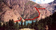
Dolpo Map online 3D.
STOL in Juphal is just long enough for take-off's. We meet our crew who had to
walk 10 days to get here from the end of the road. After our first lunch we set
out for Dunai, where we will spend the night.
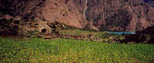
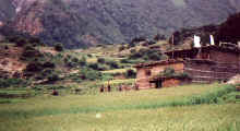
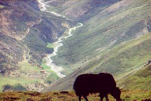
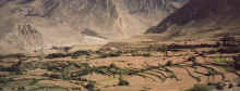
Terraced fields along the Bheri river.
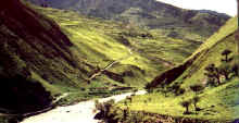
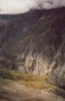
The trail descends from Juphal towards the river. Just after monsoon the valley
is still covered in a light green, after Kathmandu's polluted air the sweet
smell of herbs is a relief.
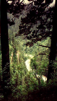
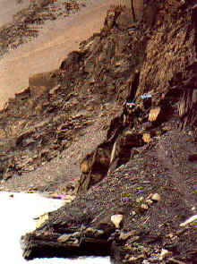
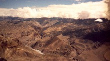
After the wide Bheri valley we climb steadily through dense forests. The
slippery trails run down at the river most of the time, but there are enough
steep climbs and descends to get some training before the high passes of Upper
Dolpo.

The 'small' Suli Gad is white-water almost the time, luckily the bridges are in
fairly good condition.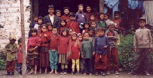 The Tapriza school gives children of nearby villages the
opportunity of a first class education. The school is funded by Westerners and
supported by the Nepalese government. The Tapriza school gives children of nearby villages the
opportunity of a first class education. The school is funded by Westerners and
supported by the Nepalese government.
[for further information about the school please get in touch with www.tapriza.org]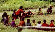
Most kids stay at the school the whole summer, Saturday is their day off and
they play games..
|
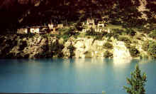
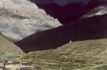
First view of the village and lake, a great change after three days in
the dense forests.
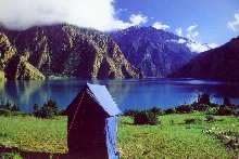
We set up our camp near the shore, a few minutes away from the village. The play
of colours is stunning, especially just after sunrise and shortly before
dusk.
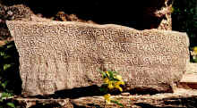
Carved stone on one of the mani walls just before the village.
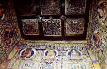
The large chorten in the village has nice paintings on all four sides and nine
fine mandalas on the ceiling.
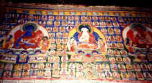
more paintings in the chorten
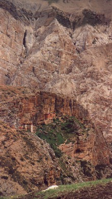
The Bon monastery stands on a cliff at the other end of the lake. It is only a
short walk in the juniper forest along the shore.
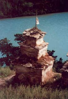
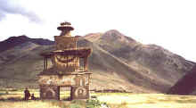
A group of several chortens announces the monastery.
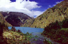
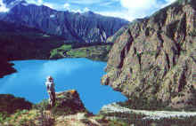
Phoksumdo lake is the source of the Suli Gad.

View from the lake towards Ringmo.
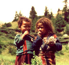
Only few men are in the village during summer, mothers and their children are on
their own.
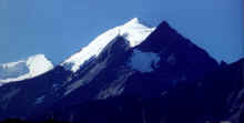
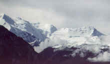
Tall mountains surround the village. Norbu Kang and the Kanjiroba massif are
above 6'000 metres, adding to the fantastic play of colours.
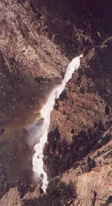
The water falls down the ridge which separates Ringmo from the valley in the
south.
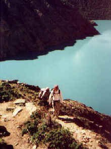
The trail to Shey starts just above the shore and then climbs high above the
lake which offers fantastic views.
After a few minutes in the shade of a forest in a glacial valley, we slowly
climb the ridge in the hot morning sun. The ochre houses and lush fields of
Ringmo are getting smaller and smaller.
Trekkers' dreams!
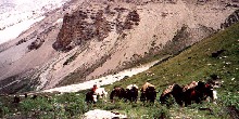
A yak caravan is coming from Shey, the first people we meet after leaving Ringmo
two days earlier.

The last mountain range that separates us from Shey. Upper Dolpo starts after
the ridge, the landscape will be dominated by barren hills and the Tibean high
plateau.
|
Far down in the valley lies Shey gompa. Tomorrow we will follow the stream
eastwards.
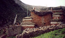
Almost hidden in the red cliffs lies Tsakhang monastery, home of the young
Tulku.
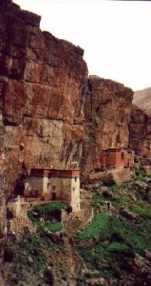
Tsakhang monastery
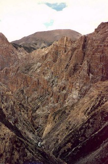
Gorge from Shey to Samling, unfortunately we did not have enough to go so far
north.
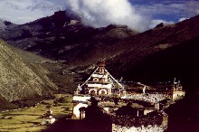
Shey Gompa becomes the centre of Upper Dolpo during a festival in June. It is
the starting point for the kora around Crystal mountain.
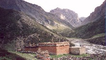
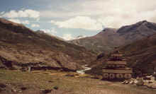
Shey gompa, built on a plateau above the rivers.
The first pass after Shey, we leave Inner Dolpo already and turn south again in
order to reach Do Tarap.
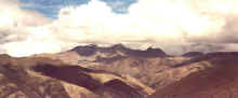
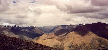
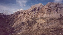
The view towards Tibet and Mustang, barren hills are followed by high mountains.
Strong wind blows dark clouds over the ridge.
|
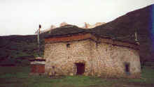
Shering Gompa lies at the upper end of the Tarap valley. Unfortunately, we find
nobody to let us in.

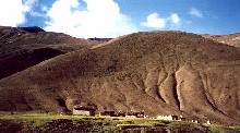
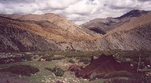
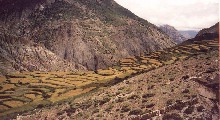
Houses are scattered admist the fields, an exception is Kagar which is built on
a gentle hill overlooking the fields.

View from Kagar towards north where we came from.
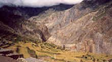
A chorten before reaching Do, a small village which lies at the foot of barren
hills.
Early morning view from the monastery above Do towards the north.
View from Do up the Ship Chok valley. The combination of sunset and a
thunderstorm illuminates the valley in a strange way.
The village Ship Chok, half an hour above the main valley.
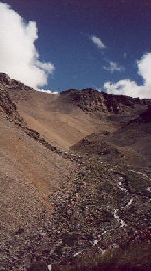
We leave the Tarap valley behind us and continue to Charkha. Another pass is in
front of us, a small path on the gravel slope leads to the ridge.
The view from the pass towards the Charkha valley.
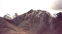
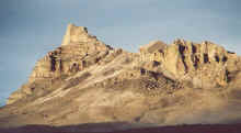
Black slate mountain near the pass.

Arid hills in ochre tones stretch to the horizon, some are high enough to have
glaciers on their tops. Small bushes grow only along the rivulets.
The area is densely populated (relatively speaking, of course), very often we
pass the brown tents of the shepherds.
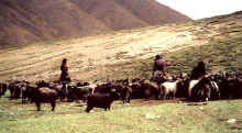
Many families from Charkha spend the summers on the pastures with their animals.
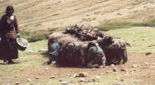
Twice a day the goats are driven down to the tents to be milked.
|
The isolated mountain shortly before reaching the Charkha valley does not seem
to be in the landscape.
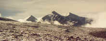
The Dhaulagiri massif, seen from the northwest. Dhaulagiri I is hidden behind
the black mountain.
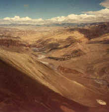
We follow the blue Barbung Khola upstream to Charkha.
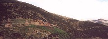
All of a sudden we reach Charkha, an isolated village which looks like a
fortress.

We are definitely off the beaten track - bridges have been washed away and are
not replaced yet - but luckily we do not have to cross rivers very often.
Trails are also getting more difficult, we choose the winter trails near the
river but sometimes the water level is still too high and we have to climb a
little.
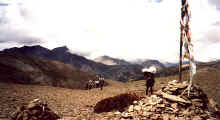
On the way to our last pass, Sangda La. It has snowed during the night which
makes the scenery even more impressive, but also makes walking more difficult.
|

Steep and narrow trails need to be taken to get from Sangda La to the Sangda
village.
The village and its field hang on the southern wall of the Sangda valley.
An oasis in a desert, Sangda village.
Last view to Sangda before reaching the ridge which runs parallel to the Kali
Gandaki river.
We follow the Kali Gandaki for the rest of the day. The trees and fields of
Tangbe village are the only sign of life.
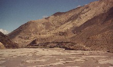
Tangbe from the pass just before Phalla village.The white riverbed is full of
water during monsoon, but Mustang is usually safe from heavy rain because all
the clouds burn off while drifting north.
Looking from Phalla pass towards south where the Nilgiri north face peaks out of
the clouds.
Pink terraces of blooming buckwheat fields surround the Phalla. Despite its
closeness to Jomosom, it does not seem to be visited by many tourists.
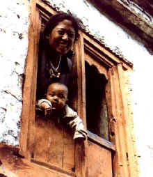
Mother and her baby looking out of the characteristic orange window in Phalla.
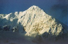
Sunrise on Nilgiri, illuminating the steep ice fall.
The broad riverbed narrows near Kagbeni whose red monastery can be seen from far
away.
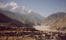
View from Kagbeni to Nilgiri.

The way along the river from Kagbeni to Jomosom is usually (over)crowded, but in
the middle of September only few tourists visit the area.
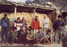
Saying good-bye. Without those people our trek would have been impossible!
|
|