MyHimalayasimpressions from |
|
|||||||

Boudha stupa is a short drive outside main Kathmandu. Tibetans and Sherpas live
in the area and often meet in the morning and late afternoon to circumambulate
the holy chorten.
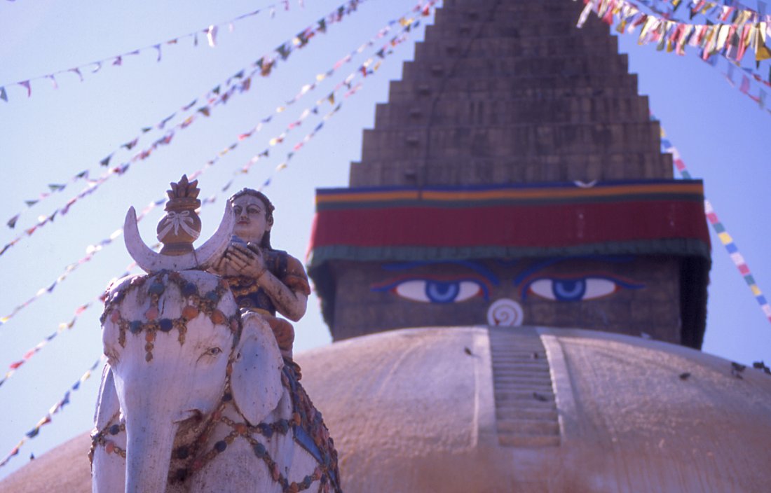
Buddha's eyes on the stupa in Boudnath gaze out in the four major directions.
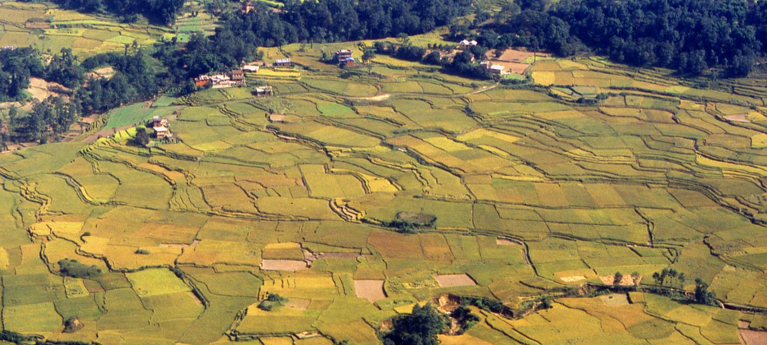
Rice fields in the flat and fertile Kathmandu valley will soon give way to
the ice-clad giants form the northern border of Nepal.
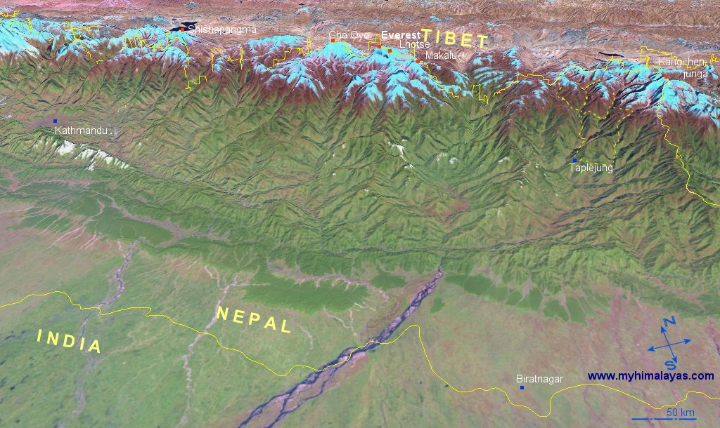
Map Kangchenjunga and East Nepal online, 3D.
Mountain flight to Everest - an easy way to see Nepal's 8 peaks over 8'000 meter.
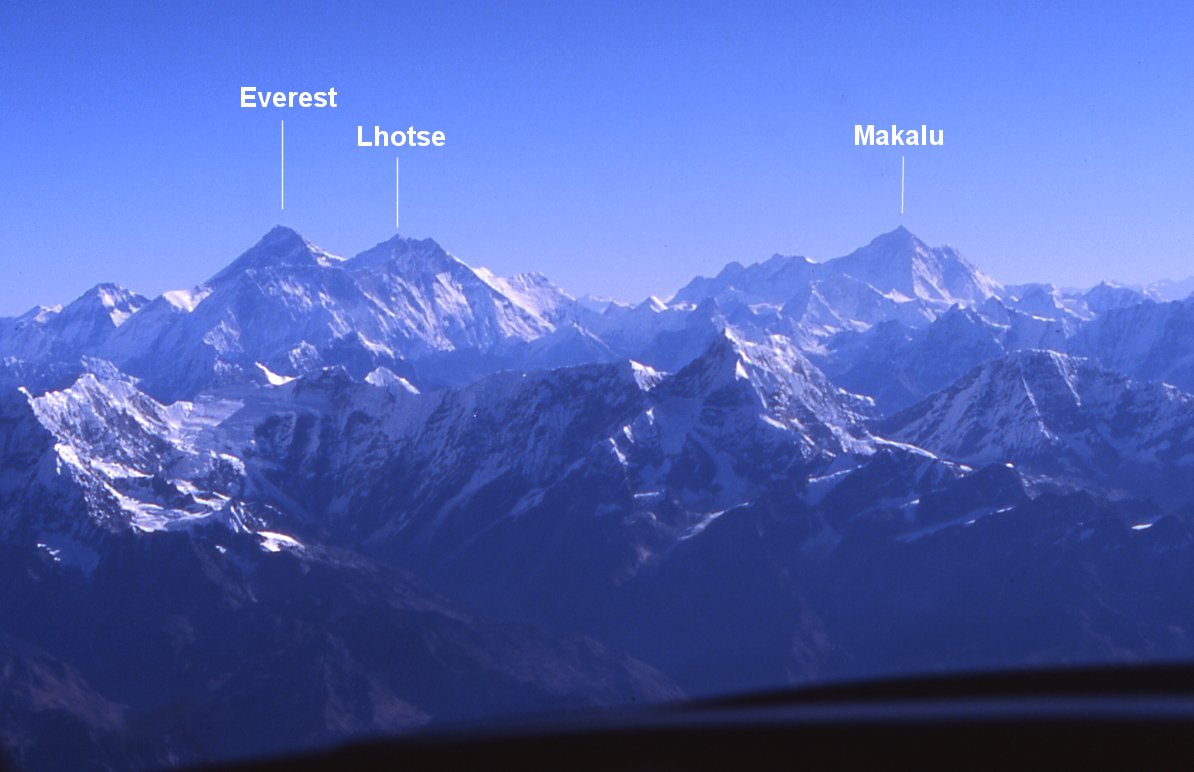
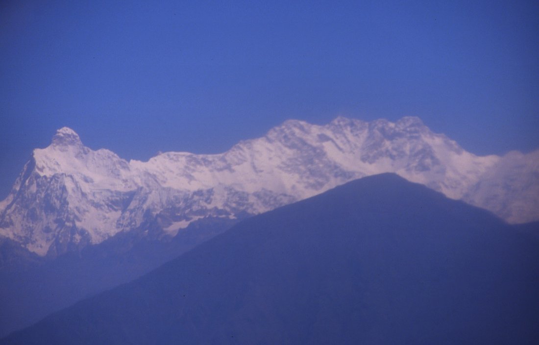
Everest (8'848 m) is the black pyramid on the left. Makalu (8'481 m) is the high
peak on the horizon on the
right. Both peaks tower above countless smaller ones in the Khumbu region. Ama
Damblam for example is just below Makalu.
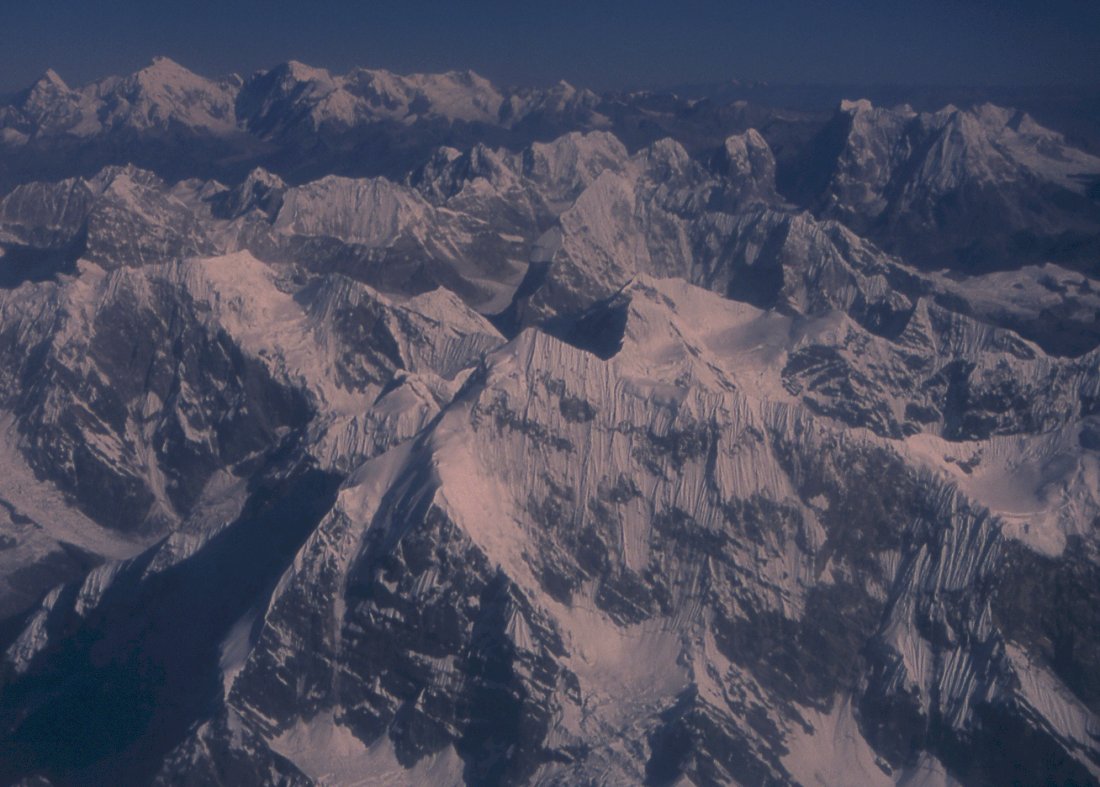
Peaks on the way to Everest.
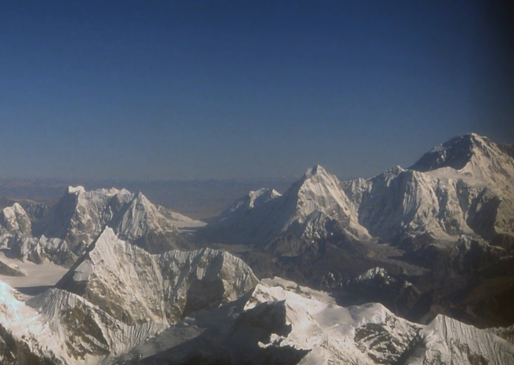
Cho Oyo (8'201), one of the technically easier summits on the
border between Nepal and Tibet.

Peaks of the Himalayas.
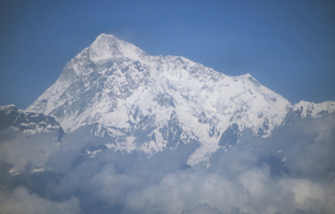
Start of our trek with a charter flight directly from Kathmandu to Suketar -
passing all the major on the way. Here is Makalu, fifth-highest peak on earth.
The Kangchenjunga range starts with Jannu on its western end and features 4
"summits" all higher than 8'000 meters.
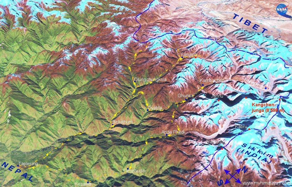
Kangchenjunga map online, 3D with our route.
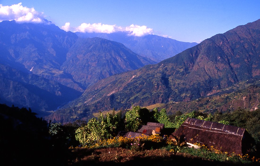
Late afternoon atmosphere in the low valley on the first day of walking, the sun
brilliantly increases the colours.
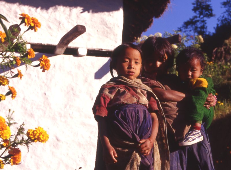
After getting back from school. kids get out of their school uniforms and
play or work around the houses.
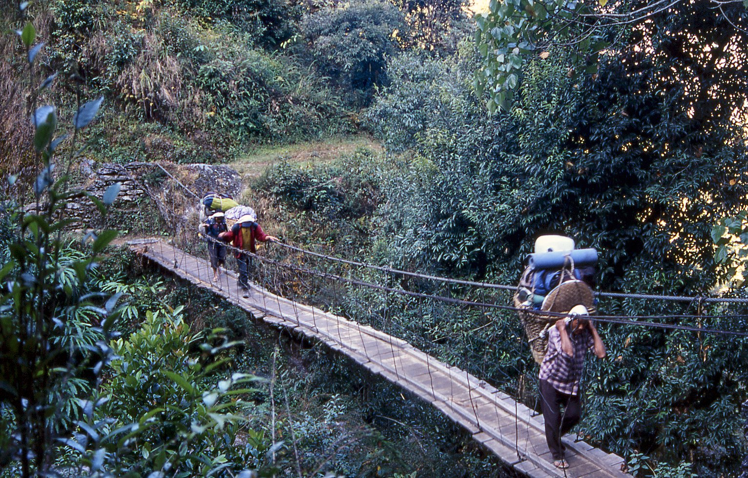
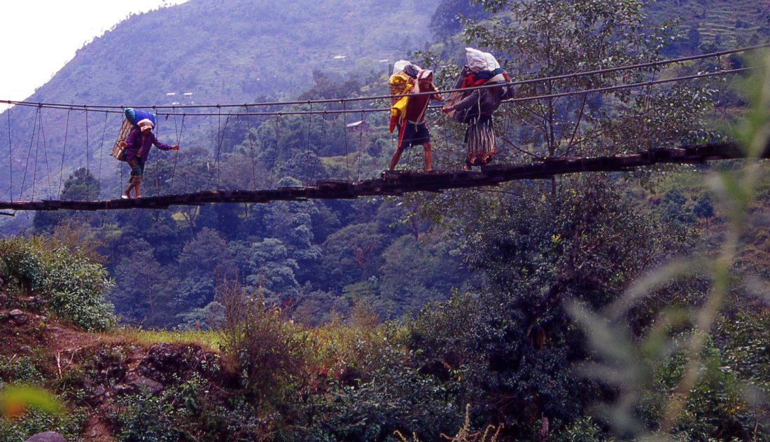
Many bridges cross the little sidevalleys in dense forests.
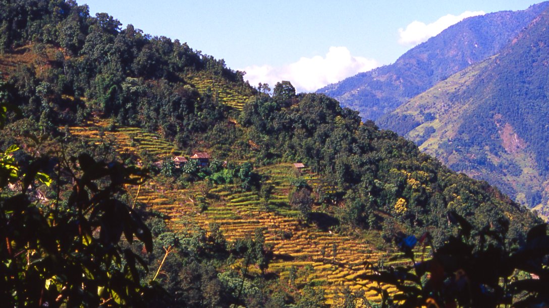
Terraces cover the hillsides along the Tamr river.
Rice is the staple diet in the lowland, higher up it is
considered a luxury because it grows only to 2'500 meters.
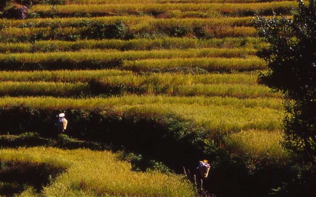
Green rice terraces are another highlight of trekking in
the lower valleys.

The few flat spots in the valley are covered by rice, the
houses are built on the hillsides.
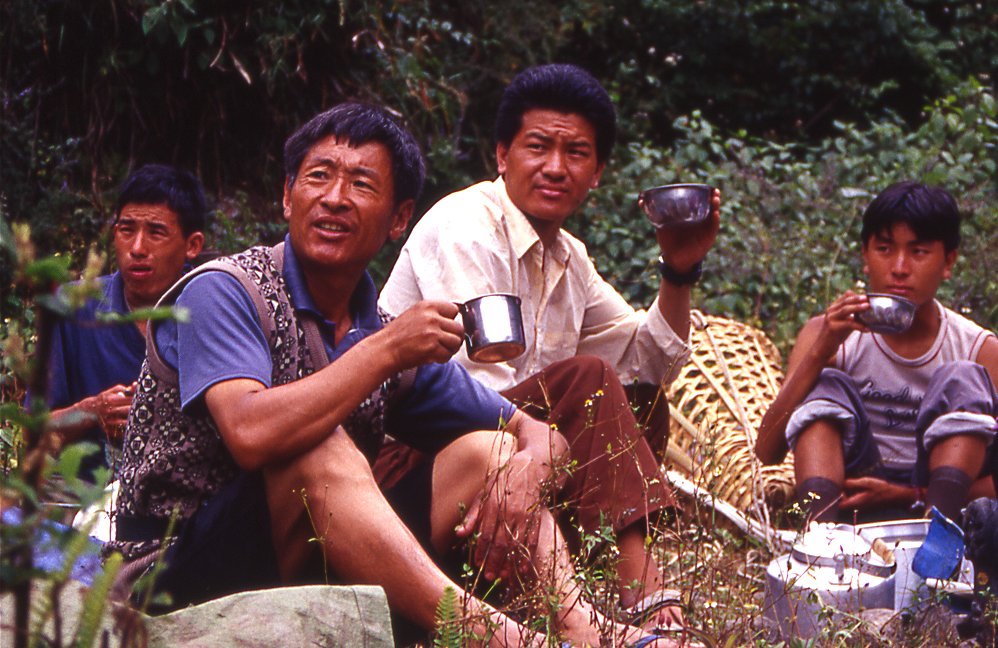
Kitchen crew and guides relax for a minute before starting
to prepare lunch.
One of the less stable bridges over a small creek, in
summer monsoon the brides are vital for locals to get around.
Kangchenjunga Olung: Kathmandu - Suketar - Sekathum
Kathmandu - Suketar - Sekathum
19 October 2003 - Kathmandu
The flight from Delhi to Kathmandu is dull at first, but when the haze disappears and white mushroom clouds indicate the small mountain range of southern Nepal I can feel my excitement increase. When we approach Nepals capital a spectacular mountain range in the north rises above the clouds and culminates in the black pyramid of Mount Everest. What a contrast to the pretty green rice terraces in the valley below.
While waiting in the taxi, I enjoy the views of Ganesh Himal and the fact that Im in Nepal once again. The airport is guarded by armed troops, and during the drive to the city I notice military posts at strategic sections. The Maoist uprising has reached the capital, giving proof of their success in the countryside despite the fact that the army has stepped in and confronts them militarily.
As usual I stay in the Hotel Utse, a cozy hotel few minutes out of Thamel. It is owned by a Tibetan couple, managed by the wife and her daughter whos in Canada right now doing further studies like so many wealthy Tibetans and Nepali. Despite the fact that Ive often come to Nepal already, it still feels very good to arrive and be greeted by people who remember you and are happy to see you.
Apart from short sightseeing trips around Thamel I take a mountain flight to Everest. Its a fine day, but the plane has to wait until the fog lifts. Eventually were in the air. The Ganesh range and Langtang that were also visible from the ground get bigger and bigger. Gauri Shankar is another mountain thats distinctive among the dozens of peaks. Then the plane changes direction and flows directly towards the mountains. The number of peaks is stunning, and to imagine that people manage to survive in the valleys is difficult. From up here it looks as if the landscape consists mainly of peaks, and a few narrow valleys in between. If youre trekking the same valleys seem large, and the peaks are the exception and not the norm, because you usually see only those peaks around you and not the overwhelming number number. Cho Oyo is the first 8000 meter peak that I spot. To the left is a pyramid peak that I remember when looking over the plateau from Tingri in Tibet back in 1998. And then there is a brown corridor leading south Nangpa La pass which is still used by yak caravans from Tibet that visit the Saturday market in Namche Bazaar.
From the cockpit the view is even more amazing: countless white peaks rise from the dark ground and pierce into the blue sky. Everest and Lhotse form the horizon, further on is Makalu and in the distance the Kangchenjunga massif rises out of the thin mist. Closer by the distinctive Ama Damblam stands out.
The plane makes a right turn and passes by Everest so closely that the south col is clearly visible. After twenty minutes this turnaround marks the start of the way back. The smaller mountains are as impressive as the 8000 m peaks, if not in height then certainly in elegance, especially where wind has formed the snow and makes the flanks look as if supported by hundreds of pillars of snow.
At Boudha I meet the rest of the group for sightseeing. Im desperately trying to find all the pieces of the Tibetan game sho para, and after half an hour succeed after a hard bargain to buy the last missing pieces, 60 small conch shells from a Nepali shop owner. In the afternoon we visit Bhaktapur together, the most beautiful of the three ancient cities in the valley. It is still intact, and both architecture and way of living offer a glimpse into the not so distant past of the kingdom.
22nd Oct 2003, Day 1: Kathmandu - Suketar - Phurumpu
Uncharacteristically for Kathmandu, the mountains were visible from the city the last two days. In the hazy distance above the green hills that surround the fertile valley, the snow-clad summits rise far into the sky. I cant wait to walk between the high valleys among those giants. Finally the trek begins.
The political situation in Nepal is tense, but in most areas trekking is still safe. (Update: In 2004 it has deteriorated. Advice: check the latest info before you decide where to go trekking). I visited many parts of Nepal, but I was lucky to find a trek at that time of the year that goes to an area that a) I havent been before and b) offers room for exploring and c) is organized by a great company.
The two valley systems west of Kangchenjunga have been opened for tourism just last year: Olungchungkola (or Wallung) and Yangma. Its remote, and due to complicated logistics not likely to be overrun anytime soon. Im trekking with projecthimalaya.com, where the mix between great organization and flexibility usually means things work out perfectly for everybody. Jamie and his girlfriend Nicola will be guiding, Joel will be leading another trek around Manaslu.
I couldnt find any current information about the area. Two books written in the 19th century describe the area briefly. In 1848 the British botanist J.D. Hooker visited Sikkim and the north-east of Nepal. Around 1880 the British Indian Survey sent the Indian pundit Chandra Das went a second time to Tibet to explore the land north of India. This time he tried a route further west of Lhonak, and passed Yangma. His acccount in the annex of Frehsfields Round Kangchenjunga stops in Yangma, and I couldnt find the entire report (supposedly it was reprinted by the American diplomat Rockhill).
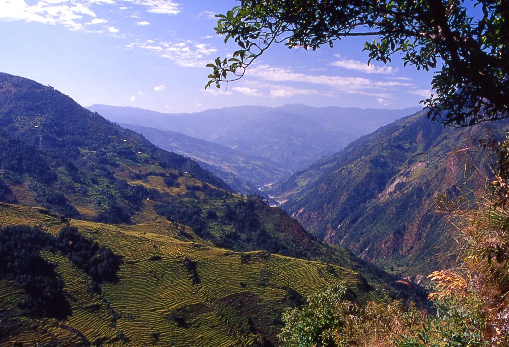
The worst chaos in the domestic airport is over when we get there at 0830. Since the weather is fine the bulk of the flights have left on time. The chartered plane that takes us directly to Suketar is full; luckily I get a left window seat. To the south are low curvy ranges that follow each other and slowly disappear in the hazy distance of the Indian subcontinent. Two minutes after take-off the single white peaks we saw from the ground become connected by further peaks and snowy ridges. Three peaks of the Ganesh range appear first, then the Langtang range with the massive 7246 meter peak and - most impressive - Gauri Shankar. The foot of the Himalayan range in the north starts off with terraced hillsides, in the valleys flow blue-grayish rivers that spring from the mountains' glaciers. All the valleys seem to lead northwards and are stopped by the range, which - after a breach that leads to the Tibetan plateau - becomes increasingly higher. The 8'000 meter peaks of Sishapangma and Cho Oyo are topped by the Everest, and then Makalu comes in sight. Though a few hundred meters lower than Everest, it is the most striking peak because no mountains block the view of its intimidating south face. The Arun river that runs in the valley below leads directly to the glaciers of the mighty mountain. Further east the range is getting lower. Just as you suspect that it has ended, the separate massif of Kangchenjunga appears and dominates the scenery. The range starts with the remarkable western outpost of Jannu (Khumbukarna). The main summit of Kangchenjunga is harder to detect because several little peaks are connected by the 15 km long ridge that runs at 8'000 m. The southern range leading up to it forms the border to Sikkim. The whole massif looks like an isolated island of ice in an ocean of green hills.
Suddenly the plane drops, and - with its nose down - seems to fly straight into a hillside. We exchange semi-reassuring looks, the pilot knows what hes doing and it must be like this. Some seconds later a flat plateau appears and thanks to the up wind the plane hits the runway. The angle of the runway slows the plane down quickly. We've arrived safely after a stunning 1-hour flight.
Our crew is waiting for us, they arrived yesterday after a tough 4-day bus ride. Farmers are happy about the summers monsoon, bus drivers arent. The rain was heavy this year and has left road conditions worse than usual. Most of the loads came by bus and are prepared already, but it will take some time to sort out and distribute our gear. Time to relax and get to know the crew and my co-trekkers: Jamie from project-himalaya.com and his girlfriend Nicola will be guiding, both were in the area last year. Tenba and Ang Dami were on my previous Manaslu trek (see http://www.myhimalayas.com/manaslu)and am happy that we can trek together again. Tremaine from Australia took a climbing course in the Khumbu before, and is mainly here for mountaineering. Andy and Sharron from England are on a world tour and have just arrived from a long river rafting tour on the Sun Kosi. Theyve done some climbs in other parts of the world. For the first few days we will trek with Jane and her husband Glenn who will then visit the north of Kangchenjunga. Everybody seems nice and easy-going.
After an early lunch we leave the village and are soon on a wide trail between fields. Corn is ripe; in some fields villagers are ploughing already. Green and yellow terraces dot the hillside higher up. During the easy downhill walk, the green millet fields become more numerous. The yellow fields are rice which will soon be harvested. Near Suketar is a large Sherpa community. The isolated hamlets further north seem to be inhabited by Limbu and Rai. When we descend into the valley, the great views of mountains we had from Suketar disappear behind a holy hill named Pathibara. We won't climb it. It is a long climb up to almost 4000 meters, but done frequently by Nepali tourists and pilgrims who visit the Hindu shrine on top. I heard of an old man who did the pilgrimage over 60 times - once every year - to honor the gods. On the right side of the Tamur valley is the other holy mountain, Manabhara, slightly lower but it seems inaccessible from here.
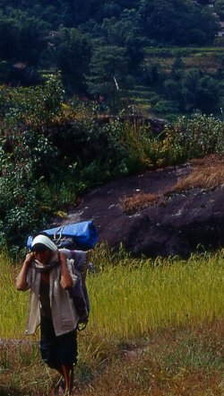
Fern and bamboo grows in the shady places where rivulets run from higher up. In those cool side valleys the variety of trees and other plants is large, in the open the smaller pants are still green but in a few weeks they will be dry and barren. Isolated houses are spread over the hillsides, the whitewashed buildings are surrounded by terraces. Flowers, vegetables and trees grow around the house. The orange of marigolds mixes nicely with the red and white walls of the thatched roofed houses. Parents' are out mending the fields, and their children in blue school uniforms are on their way home. They are shy and start to giggle when being asked simple questions in English. The pleasant temperatures, fragrant wind and nice afternoon sunlight make this a perfect first day in the middle hills. We walk through the millet fields, pass the houses and enjoy the stunning and relaxing atmosphere. The hills get higher towards north, cumulus clouds mushroom into the blue afternoon sky.
Phurumpu - Chiruwa (Day 2)
After a wonderfully relaxing sleep a rooster wakes me, and not the screaming of school children. The school where we camped in the courtyard does not seem to be used anymore. It might have been closed down by the Maoists.
Today's route will have some up's and down's and be a gentle introduction for our leg muscles. In the afternoon we should hit the Tamur river and camp near its bank. At first the trail leads down into a dense forest. Moss, bamboo and fern grow along the path. Bridges cross the numerous creeks that flow down in narrow and steep green valleys. Some of the bridges are rather old, the foundation is usually fine but the wooden planks are either missing or squeaking, swinging is included. Where the forest has be cleared a little, people set up cardamom plantations: the dark green leaves stand out in he shade of the forest.
The scenery gets prettier and prettier. The dry cornfields have ended and endless rice terraces cover the hills. They look like golden steps that climb up from far down and end just below the ridges. The blue sky contrasts nicely with the yellow color, white puffy clouds add to the whole scenery. Far down the Tamur flows towards the plains, rapids add white tones to the greenish river. Where the monsoon washed away the trail we have to do a detour and climb up steeply. The reward is a fine walk through the fields to settlements above the main trail which are very picturesque. Flowers and vegetable gardens make the locations even nicer. In separate open air stables are pigs, chickens run around the house. Goats and cows are not left alone to roam around. Kids or women watch the valuable livestock. Of course their lives aren't as idyllic as it seems, but compared to the life in the Terai it seems much better.
Around noon the sun beats down strongly, and during the many short climbs sweat flows and the salt burns in the eyes. In the forest it is much cooler than on the exposed parts. After taking the wrong trail I end up in the village Thiwa. A friendly man walks me through backyards to the main trail again. I notice somebody sitting on the gate above the bridge that spans a deep side-valley. When I'm down at the bridge he still sits there. Somehow I get a strange feeling, people don't just sit for minutes on end, and the person is too big to be just a kid with spare time. Since we're in Maobadi country I wait for the rest of the group. My feeling was right; the boy (probably not older than 18) is a "representative" of the Maoist party and asks for "donations". Our crew is intimidated. Jamie tells him to "come to camp because you don't just ask people for money on the trail". Surprisingly enough were allowed to go on.
From Thiwa on the scenery changes: the hillsides get steeper and only burned yellow fern manages to cling to the dark rock. The terrain gets rougher, the river is constant whitewater. A few more climbs and descends, and then the trail reaches the river. Huge black boulders are strewn over the wide valley. Chiruwa, a collection of half a dozen houses, lies between the rocks. We pass the village and head to the campsite thats on an empty rice field a few minutes outside the village. The black rocks in the yellow rice increase the stunning colors. The village earns a little money for renting the space and the simple shelters which we use as a kitchen. After dropping the loads, the porters are about to leave to find a place to stay in the village when the "Maoist representative" arrives. He has a long discussion with Jamie. The porters crowd around and listen carefully, laughing at some of Jamie's comments. The Maobadi is in the defense and seems more nervous than Jamie. If he weren't extorting money from us you'd feel sorry for him. The original price of 5'000 rupees for each tourist (US$ 70) eventually drops to US$ 15. After handing out the receipt the kid leaves and we won't be bothered again. This easy confrontation with Maoists gives some tourists the false impressions that the Maoists are nice, well-behaved people that aren't a threat to anyone. Their treatment of villagers is often harsher, both by Maoists themselves but also by the army.
As dusk sets in, the last of the porters arrived. This has been a long day, and the loads are still quite heavy since we haven't used much fuel or food yet. Im also tired, the drop of 300 meters was achieved with climbing up and down, and not straight-forward. Im not in great shape yet.
Chiruwa - Sekathum (Day 3)
I wake up a few times sweating, the night is quite warm. In the early morning some raindrops hit the tent, at breakfast clouds still linger but the rain has stopped. The overcast makes it cooler than yesterday, but after a few minutes the humidity makes me sweating like the previous day. The valley was probably formed by a glacier a long time ago; high above the river the rocks are completely smooth. Monsoon rain has led to quite a high water, and large parts of the riverbank were tore down some weeks ago. Dense jungle grows along the Tamur river, after an hour the valley opens up at Tapethok.
The flat valley floor is covered by rice fields which are almost ready for harvesting. Dotted in the hillsides stand dozens of houses. Trees separate the various tones of green and yellow. Harvesting the terraces must be incredibly hard work, considering the number of the endless little fields and the steepness. In those parts of the valley that are too steep for agriculture, the forest is still dense. Moss and lichen cover the trees and rocks. Small rivulets cross the path. Cardamom was planted in the flat parts of the forest. For a long time we walk without passing any houses. Just before Tamewa, where we have lunch, a large flock of goat is crossing the suspension bridge on their way south to Taplejung. Another bridge with ancient planks crosses the rivulet that must be a torrent during the summer monsoon. After regular lunch I get an additional portion of spicy vegetable potato curry with rice.
Villages haven't seen any development in the last three years, on the contrary. Where there were lodges, teahouses or local shops that created a little profit from tourists and local travelers, the houses are all locked up. The Maoists have forbidden the sale of soft drinks and beer. In some parts of Nepal women initially welcomed the ban of alcohol, though the ban of regular beer doesn't safe villages from alcoholism since it was too expensive for locals anyway. Too much entrepreneurship is probably also suspicious to the Maoists, though this is just my guess. The lack of income leads to a quick reduction of opportunities in a region where agriculture is the only industry, and cardamom the only cash crop and thus the only possibility to generate cash. The cherry-sized fruit has a sweet and stingy taste, reminding me of toothpaste. Not many places on earth are suitable for its cultivation, and the demand for it as sweetener, spice and medicine is large. 1 kilo is worth eight dollars. After harvesting the pulps are dried over an open fire, then carried in bags to Taplejung and exported to India via Biretnagar.
From high above the river we look down the valley where we came from, and ahead to Sekathum where we will camp tonight. The steep walls are covered by trees; moss and lichen become a more dominant feature in the inaccessible parts of the valley. Fallen leaves make the trail look like a red carpet in a green tunnel. In the dry parts along the river, pine needles cover the path. The yellow fern creates a very different atmosphere. The variety of butterflies is decreasing, and they are becoming smaller and less colorful the higher we get. The afternoon walk is short, after another climb we traverse a steep rock face and descend in the forest of a side valley. The water from the glacier of Kanchenjunga merges with the Tamur that springs 50 kilometers further north. After a cold but refreshing bath in the glacial water and a set of new clothes the comfort level has reached a new height. Just before dinner as dusk sets in and the trees are reduced to contours, it starts to drizzle. It gets chilly and the soup is a very welcome starter of another fine dinner.
|
Summary Part 1:
The first landmark of Nepal is visible on my flight from Delhi to Kathmandu: Mount Everest. On the mountain flight I take the next I get even closer to the highest peak, and more spectacular views of several other 8'000 meter peaks. After two more days of sightseeing in the capital we meet our crew and start our trek in Suketar in Nepal's north-east. The area is fertile, in the shade of the thick forests grows bamboo, fern and cardomom. Rice terraces cover the hillsides, millet grows on the fields around the pretty whitewashed houses. Small vegetable gardens and flowers grow around the houses, giving an idyllic picture of farm live. The idyl is disrupted by meeting a Maoists who asks for donations. Refusing is not an option, and though the price is drastically reduced it leaves a bitter suspicion that the money is not being used for worthwile projects but for direct support of an armed conflict. Before Sekathum the scenery changes and the valley gets narrow. Terraces get steeper and smaller, and the jungle seems impenetratable at times. The only day of rain on the entire trek gives us the only restday. |